Showing posts with label Utah. Show all posts

Sunday, October 6, 2019

Great Basin, and Great Scenery

2019-10-06 (Sunday)

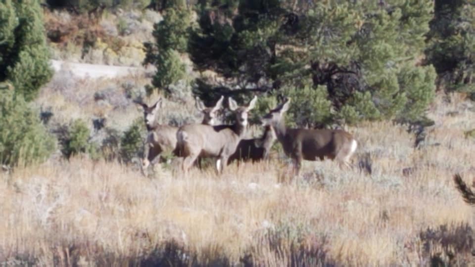
We woke up to blue skies again, and another cold morning. But after getting ourselves all ready to leave Great Basin National Park, we went on a walk first. And that changed our whole perspective of the park! I was just about to take a photo of our truly beautifully located campsite (inconvenient though it was to get into last night), when Joe and Cassie noticed a small herd of deer in the site next to us. They slowly came into sight behind us, and until Cassie barked, they were just going about their business. That was a nice scene.

There's a deer to the right of the big tree


Then Joey pointed out the pinyon pine nuts on the trees growing next to us. The park's newspaper specifically says that these nuts can be gathered during their season. Well, it seems this is the season! I gathered two pocketsful of nuts--they will have to be shelled, but still, we got them fresh on the ground right under the tree. There were zillions--the park allows 25 lbs per family per year. I guess there must be millions going to waste, but we will take some home.

Then we followed the sound of a rushing brook, and it was lovely too! Really, it's an inconvenient campground in some ways, but the location is absolutely gorgeous. On our way out, the view of the valley ahead of us was fantastic also.

Valley view
 I was feeling fine, and able to drive the RV down the mountain to the visitor center, while Joe drove the Jeep. We were aggravated to find the center was closed until Wednesday, so we couldn't look at the displays, or pick up my pin! However, Joe discovered a small item which needed repair on one of the RV wheels, so he took care of that. We then got some gas, and headed for Utah-- we were only about 10 miles from the border.

The Loneliest Highway continues into Utah--but the mountains come sooner, and are very cool. I have to save my greatest superlatives for later in the day, but I didn't remember that, so I took some photos of the mountains as we went through them. Joe said, "Didn't we drive this road before? I remember this scenery!" And then I remembered, we did-- we drove this same route in 2007!

Western Utah, US-50

Remembering that helped when US 50 finally merged with I-70 in Salina, Utah. The stretch from there to Green River, a bit over 100 miles, has no services at all-- but it is the most spectacular road I've ever driven. I didn't even try to take many photos, because I remembered I took dozens with my good camera in 2007. So I am going to revisit those for this  blog and save time, LOL!  We even stopped at the same scenic pullout, and took some of the same exact photos (I couldn't resist, after all.) There was an Indian woman with her jewelry and pottery spread out at the pullout, as well, and I bought myself a necklace. It will make me think of that location when I wear it!

  Suffice to say that the road was beyond exquisite-- there are not enough superlatives to describe the incredible rock formations and colors that you pass in those 100 miles. Not to mention all the steep climbs and scary descents you have to drive down!

Teaser: Moon over the Rafael Swell on I-70, Utah
 I drove the last hour of the trip, as Joe finally admitted to being a bit weary (no wonder! He'd been the only driver for the past two days, on some pretty difficult mountain roads.) We were headed for Green River, where we stopped over in 2007. But this time, we decided to go to the Green River State Park. As usual lately, we got here a bit later than planned, and it was dark. We were very happy to see there was a ranger in the welcome booth, who could send us to the only empty site in the park--a group site. As such, it had plenty of room for us, although we did unhook the Jeep to back in.


Wednesday, August 22, 2018

Very Long Ago, and Very High Up

Sunday, Aug. 19, 2018

This was another one of our amazing days, I think! We woke up as planned, a bit early, because we knew we had a long day ahead of us. We just didn’t realize HOW long it would be!

Our first stop was, of course, the visitor’s center at Dinosaur National Monument. We first watched a 12-minute video about the dinosaurs and natural impact of the Green River Valley in that area. The reason there are so many dinosaur bones here is because the “ancestral Green River” washed a lot of bones into one spot. But as we learned, the site is misleading, because all the bones here are of huge dinosaurs-- the smaller bones were washed away or otherwise decayed before they ended up in the “dinosaur bone jam” in this particular location.

Wall entirely embedded with fossilized dinosaur bones
Then we hopped onto the tram which took us up through layers of earth to the viewing center. The building is fantastic-- it is built right against the original wall of fossils which were excavated in the first decades of the 20th century. You can’t help but go WOW when you first walk in and see the wall of bones still embedded into the rock.


There are excellent displays to help get oriented to what we saw. The large wall in front of us was originally about 3 times larger-- the areas above it and to the right and left were excavated earlier, as I said. The fossilized bones which were removed are now in museums all over the country, with three complete skeletons in the Carnegie Museum in Pittsburgh-- now on Joe’s and my list for a long weekend visit so we can see them. (Other bone are also closer-- in NYC and even one in a museum in Newark, DE, if I recall correctly!)

Allosaurus in rock
For $1.00 we purchased a brochure which helped us identify individual sections of the wall and better “see” the bones and how they belonged together (if, in fact, they actually did-- a number are just stray individual bones.) So we looked at them carefully, and Joe pointed out some specific bones which he could identify from his knowledge of anatomy. There were also a lot of panels with photos explaining how the bones were originally excavated, wrapped in burlap and then plaster, then put into boxes and pulled on skids down the mountain to wagons, and hence to the nearest railroad depot where they were shipped back east. The entire area was absolutely fascinating, and we spent at least an hour there.

Placement of bones in wall and reconstructed skeleton in NYC
We left the monument just about noon, and had to stop at an RV park in Jensen to dump our tanks, fill up with fresh water, and buy a bag of ice. Then we finally headed toward central Colorado, where we were meeting Ben and Miriam. I had already gotten a number of texts from Ben, and he was going to send us more info after they found a nice campground for us to meet up at.
Camarasaurus skull

Joe points to corresponding place on his hip
We headed east, crossed into Colorado, and stopped at the Welcome Center in Dinosaur, Colorado, to pick up some info. I chatted briefly with the two people working there, and pointed out the route I was planning to take-- it seemed like the most direct route--through Aspen and down toward Salida, which was the general area Ben was heading for. All they said was, “Well, that sure will be a pretty drive!” And then we continued on.

We stopped in Rangely for a lunch break, and then kept going. My plan included picking up I-70 at a town called Rifle, heading east to Glenwood Falls, and stopping there for a Walmart stop before continuing on. That looked to me like the exit to go south on my planned route, but my GPS kept telling me to go farther along I-70 before heading south, and I decided maybe that was a better idea, although it looked like more miles to me. But the GPS was calculating the fastest route, so I figured I’d trust it.

As we got on the interstate at Rifle, there I saw a Walmart! But it was too late, so we continued with the original plan to stop at the Glenwood Falls Walmart. This was only about 30 miles or so down the interstate, and we got off there. I quickly discovered that Glenwood Falls was actually a resort city, with a large hot springs hotel and pool there, and that the exit from the interstate put us right in the center of a charming but very busy downtown, full of cute looking businesses and restaurants and historical buildings. There was no sight of a Walmart anywhere, which we have come to expect when we use Next Exit to tell us what exits have Walmart. So we had to hastily look for a GPS guide to Walmart.

The GPS worked, although it first took us to a tiny road which was closed. We could at least see the Walmart from there, however, and used our own eyes to get us there. It turned out to be an older store, not a Super Center, and as such it 1) had a very small parking lot; 2) was relatively difficult to get to; and 3) did not have fresh veggies and fruits. However, we were able to get almost everything we wanted, with the exception of sufficient bottled water. The plus side was, it was a smallish store, so it didn’t take us a full hour to get through it.

My first inkling that this was a mistake
And then, we plugged our destination back in-- by now, we knew Ben was at Cascade Campground a little south of a town called Buena Vista. I found it on my map. And now the GPS told me to go MY original route-- keep heading south through Aspen, in almost a direct line to Buena Vista. So I figured, ok-- we’ll switch back to that route again.

Well! It was only about 10 minutes before I was having serious misgivings. Even though the road was a divided highway with 2 lanes each way, we were steadily rising, and I was having a very anxious feeling that we should have gone back to the interstate and use the GPS’s original suggestion. Soon enough, we got to Aspen-- and negotiated carefully through the center of town. And then the road was 2 lanes, and fairly narrow. But okay, this is Colorado, and we were going through the mountains, going up still. But it did seem narrower than I would have preferred, for sure.

Uh oh. The road didn’t have much in the way of a shoulder or a railing. There were a lot of hiking trails around, though. It seemed like a very SMALL road, although it was the only road there was! Unless we turned around and went all the way back to Glenwood Springs, that is.

Double uh oh!! We passed a sign that said, “Lights will flash automatically if vehicle oversized.” But they weren’t flashing, so.... we kept going. And a little further: “Turn around for over-sized vehicles,” with a pull-out. At least there was now a sign-- vehicles over 35' forbidden to proceed. We are under 30 feet. But man, that was NOT reassuring! What WERE we heading for, anyway?
Hairpin turn

We passed several forest service campground areas and a LOT of trail heads. Not much else. The road was not very wide. Whenever we passed ANYONE I had a small anxiety attack. And then a sign: “road narrows.” I said, “narrower than THIS??” And now suddenly the double yellow line disappeared-- the road was so narrow that if they’d put in a line, the space on either side would not have been wide enough! And, did I mention, we were on the OUTSIDE of the road, i.e. looking DOWN as we went around the side of the mountains? We came to at least three of these “narrow” sections. They were just terrifying, because they BARELY wide enough for two cars, but a car and an RV? They were NOT WIDE ENOUGH. And every single one went around the mountain, so we couldn’t see if anything was coming, although it usually was. At one point, we stopped JUST as the road narrowed, because I yelled STOP! to Joe. I could see that if we did not, we’d be face to face with a car and no room for either of us to pass. We waited until 4 cars went past us, then prayed as we went through ourselves.

By this time, I had my eyes closed at least half the time. The speed limit was 20 mph most of the time, sometimes only 15 and on some particularly sharp turns, 10mph. I was having a real panic attack, and practically ready to cry. Joe, meanwhile was doing GREAT. He drove the whole way in 1st gear most of the time, I think, and he was calm as could be. (I was also worrying because it was getting so late-- almost 7pm--and I thought he needed to eat soon! And also, my GPS kept telling me
Drop off on the right. No guardrail.
that the time between us and our destination was getting LONGER each time I checked!)

Finally, FINALLY, we came to the top-- beyond the tree line, to find a big pullout area and a sign that said, Continental Divide, 12,095 feet. Well, no WONDER I was panicking-- I was oxygen deprived! (Joe pointed out that airplane cabins are pressurized for 10,000 feet-- and that our oxygen masks would have dropped 2,000 feet earlier!) There were a number of people parked up there, with some information panels and even pit “restrooms.” Clearly, this was a “destination,” which is why we had so many cars passing us. I found out from the panels that this was Independence Pass, and it is the highest paved road in North American!!! Another panel mentioned that “the Narrows,” as they are called, have been panic-inducing since the pass was first used. No-Duh!!
"Road narrows". TOO NARROW!!

There was a short path to an even higher observation point. I was just unable to walk up it-- I was so shaky and weak and wobbly when I got out with Cassie, I almost fell over! There was a nice young man who offered to take my photo in front of the Continental Divide sign, and he asked which side we’d come from. I said, Aspen, and he reassured me that the other side was “much much easier,” that we’d come from the “hard side.” Honestly, I was VERY glad to hear it-- I didn’t think I could take much more! (Then he added that there were “only” about 3 more hairpin turns! And then I heard him tell his friend, “They came up in that RV!” and I could tell he thought THAT was a bit gutsy! But we had NO IDEA what we were getting into!!) Meanwhile, while I was outside, Joe checked his sugar, which was great, and he ate a little bit anyway so it wouldn’t drop at an inconvenient moment on our way down. Even Cassie got into the act, placing a “deposit” on the highest paved highway in North America!

Above the tree line
So I took some deep breaths (as deep as possible, that is) and we started rolling DOWN the mountain. Although it had its scary moments (we were still on the “outside”, and I could look straight down over the edge of the road to the valley below), it was nothing as bad as coming up had been--the road was wide enough for double yellow lines all the way, and the speed limit went all the way up to 35mph! By this time, though, I was worried about the time. I knew that the campground we were going to was NOT going to be well lit, and I was anxious about actually finding it. I’d originally thought we might get there at 7:30, and now it looked like being 8:30 or even later. We’d had no phone “bars” pretty much since we’d left Aspen, but when we finally came down from Independence Pass, they finally came back. I was able to call Ben, who reassured us that we were almost there and gave us a few more landmarks to watch for, and then we kept on.

We found our turnoff (after disregarding GPS’s suggestion of a side road--I’d had enough of THAT!) but by this time, it was dark. We drove slowly along a county road, and there was more traffic than I expected. It was entirely unclear from the map how far along we’d have to go, and we had trouble seeing some of the road signs. When we saw a sign that said “National Forest Campgrounds ahead,” we were SO reassured! But still there was mostly black road and not much else until I realized there were actually homes on this road, and then the Mount Princeton Hot Springs Resort, accounting for the oddly mystifying traffic. After we passed that, I got out our super-high-power flashlight, and I opened the window, and every time we saw any kind of sign, I held my arm out the window to illuminate it with the flashlight. And so we proceeded until, Eureka! The sign for Cascade Campground, and the turnoff. Then it was a relatively simple matter to make our way through the campground loop until we came to site 8, which Ben had reserved for us, and there he was, waving. So Joe got out and guided me while I backed in. And miraculously, it was flat!

It was 9:00 and pitch black in the campground, but Ben had the coals of a good fire going, so we sat and talked to him and Miriam (and Judah-bear, who is 14 months old and was wide awake). Joe soon went to lie down, and I sat with them just a little longer before realizing that this long day and all the adrenaline rushing during the couple of hours we drove over Independence Pass had really exhausted me as well. So we said goodnight, and I stumbled across to our campsite. Joe made us some scrambled eggs (we still hadn’t eaten) and then we passed out in bed.

Joe was FANTASTIC driving over that pass. He didn’t seem at all nervous, and he was in total control of the RV the entire time. I, on the other hand, apparently do not respond well to 1) heights; 2) lack of oxygen; 3) lack of knowledge of where I am going. I was a genuine wreck. According to Ben and Miriam, we have now negotiated the two “worst” (i.e. highest and scariest) roads in Colorado-- Independence Pass, and Route 550 from Durango to Ouray, which we did in 2015. But with the latter, we KNEW what we were getting into, and it was broad daylight. Today’s adventure was a total surprise, and turns out, I don’t do very well with those! But Joe was completely unfazed. So now we know whose nerves are better!

Saturday, August 18, 2018

Driving the Beautiful Highway

Saturday, Aug. 18, 2018

Sometime during last night, the wind must have died down, because the lake was quiet this morning when we woke up. But we’d slept very well, and the view was just amazing! It was hard to leave, but we knew we had a long drive ahead of us.

We went VERY slowly for the first 30 minutes or so, due to the incredibly hacked up roadway along the east side of Bear Lake. But that gave us the opportunity to notice that every other campground we passed was crowded, small, and so much less desirable than Rainbow, where we were, and (btw) we drove around Rainbow before we left, noticing that the other sites, while large and all with a great view, could not compare to the solitude of our campsite. So we TRULY lucked out last night!
Cassie at Bear Lake
Sheep Creek Bay

We finally got through the construction, and began traveling at normal speeds. Rather than describe the road, I am going to link to my blog from 2011, when we drove this exact same route. I took great photos last time (back then, I used a “real” camera, not a phone!), and the descriptions are quite detailed!

Like last time, we did not arrive in time to really get to Dinosaur National Monument, which was our definite plan today. I was bemoaning not having those lost hours of driving from yesterday! But after obsessing about several options, we finally decidedd to at least come down to the Visitor’s Center and see that, and then we would look for a place as close as possible for overnight. Then tomorrow, we would make ourselves get going earlier so we could see the Fossil Wall under glass, which is the real reason we came here in the first place (if you read 2011‘s blog from the day after the drive, you will know what happened to us on that earlier visit. And by the way, we saw the same pink dinosaur today!)

So we came to the visitor’s center, only to find out that there really isn’t much there. The reason to come is to take the shuttle from there to the Fossil Wall. But we got there about 4:45 or so, and if we’d taken the 5pm shuttle, we would have had only 30 minutes, because the last shuttle left the Fossil Wall at 5:30. Instead, I asked the ranger about whether the campground here in the park would likely be full, and was thrilled to find out that it was not! So instead of having to drive around, or back to Vernal to a commercial RV park, we drove another 5 minutes or so into the park here, and got an absolutely lovely spot in the campground as near as possible for tomorrow morning’s trip to see the fossils. And yay-- it cost us only $9 (half price), because we are old! (Just kidding--it was that great American the Beautiful pass again!)

So we stopped early, had time to make a delicious steak and baked potato dinner, and it’s only 8:15, but my blog is almost done! I will upload this, and yesterday’s photos (which finally came through today), and try to fall asleep early. Then we plan to get up early, see dinosaur fossils, and then drive another 5 hours or so to meet Ben and Miriam. We are most likely NOT going to have ANY cell phone connections there (in the Colorado Rockies), so most likely this blog will be it until maybe sometime Tuesday night.

Oh, we DID have some excitement right after we set up our campsite. We’d been hearing thunder on and off ever since arriving at the visitor’s center, and even drove through some brief rain showers on our way. But suddenly, it started pouring-- and then HAILING!!  For several minutes we had this amazing hailstorm, with the sun still shining on us from the other direction, and a rainbow too! Mother Nature certainly is amazing, as the photos of Sheep Creek Bay will prove!
Map of our current location


Friday, August 17, 2018

It has BEEN a DAY!

Map of Bear Lake. We are the blue dot.
Friday, Aug. 17, 2018

This has been one heck of a day, from beginning to end.

Joe and I both slept so wonderfully last night in the Flying J parking lot. Whatever noise there was outside, it didn’t bother either of us, even with our windows open. We had nice cool air and we slept quite late, I think it was after 8:00 when I woke up!

From there, we started slowly. I even took a lot of time to upload photos etc. for the past two blogs. When I finally took Cassie out for her walk, it was a beautiful day--a blue sky, and in the low 70s (but the air IS dry, so it felt perfect.) Joe felt great after his night’s sleep too, and both of us were just feeling smug as could be at how well we felt and what a nice day we were expecting. And because he was feeling so good, and it was comfortable outside, and we were at the Flying J on a flat surface (and would be able to get anything automotive we needed), and we didn’t have to hit the road asap, Joe decided it would be a good morning to do the oil change that Sam (the RV) needed by now, about 3,000 miles since the last change.

He’s changed the oil often. He has all the equipment. So we didn’t expect any problems. He got out all the stuff he needed and slid underneath Sam to open the valve and drain the used oil into a pan. He called me for help with finding the right size socket when the one he had didn’t quite fit, and I stayed around to help pour the used oil into an empty container when it was all drained (that turned out to be a big pain, and I had to run into Flying J to buy a funnel to help with the job. But a bit went onto the asphalt). He added the new oil into the engine. And in about 45 minutes or so, the job was finished.

But after I threw away all the empty oil bottles and came back to the RV, I found him worriedly sitting at the table. He said, “I may have done something absolutely terrible.” It turned out, he was afraid he had drained out, not the used oil, but all the transmission fluid instead. The two valves are quite close to each other under the rig. He asked me what color the liquid was when I poured it from the pan into the empty bottle. Because some of it had spilled, and I’d done a lot of wiping it up, I had noticed the fluid was pinkish. Which is the color of transmission fluid. That confirmed his worry. For about an hour, he kept reading the manuals and looking online at some videos, he went back under the RV, and he used the little dipsticks to test the levels. It seemed like the oil was full, but the transmission indicator didn’t seem to have ANY liquid on it. Uh oh.

Eventually, he was convinced that he had, indeed, drained out the wrong stuff. I was still calm-- all it needed was for us to obtain 7 quarts of transmission fluid and pour it into the engine. We were sure Flying J would have it. But.... they told us they did not.

Now we had a problem. We could not go ANYWHERE with no transmission fluid. We looked up local auto centers/mechanics/services. We found 2 names in McCammon (which is the town we were in) and one at Lava Hot Springs, 12 miles down the road where we were last night. But one place was a disconnected number, one was leave a message and I’ll call you back. The third said they had the fluid at the shop, but “everyone is out on a service call” and they would call back when someone got in.

We pondered trying to get up to Pocatello, about 20 miles away, where they would have everything, but it was a shlep and we might have trouble getting back (we were picturing hitch hiking-- there was no Uber service!) Then I went into Flying J and they gave me a list of guys who had left their numbers at the place in case someone needed help. The first was another “leave a number,” but we finally found a guy who sounded intelligent! He had a mobile service business and said he could bring us the transmission fluid. All this had taken at least a couple of hours-- it was now already after noon. But we were very relieved to have SOMEONE who could help us.

At this point, as we waited, I made Joe change his clothes-- his shirt was soaked in oil, and his shorts were filthy. The new shorts he put on were missing a button, and he went into the Flying J to get a sewing kit, even though I had a small one. They didn’t have that, either! He said to the woman, “You guys are really letting me down! No sewing kit... no transmission fluid....” And she said, “I might have transmission fluid! I will look in the back.”  And she had 5 quarts after all!!

So Joe came back and added the fluid into the engine, and got a reading that it was “enough”. He yelled, “Call the guy, maybe you can catch him so he doesn’t have to come!” but just at that minute, the guy pulled up next to us. So he and Joe did some more diagnosing, we needed two more quarts of fluid (which he had brought), and after some more back and forth, it was decreed that Sam was roadworthy again. The funniest part was-- our savior was a Kiwi-- he had a lovely New Zealand accent, and he and Joe talked about his history (he came to America 30 years ago to work on race cars, and ended up staying in Idaho.) In the end, he charged us a flat $200 cash (mostly for his time, not the transmission fluid), which was a break. Joe thinks it was because he felt sorry for us, and liked Joe. But whatever, it WAS maybe dumb, but it would have been much worse if we could not have gotten what we needed.

By this time it was 2pm, and we were pretty hungry and jumpy. We drove back to Lava Hot Springs and found our same parking spot from last night. Then we decided that we should eat out rather than try to fix anything--it was hot and we were tired and hungry. The only restaurant right near us was a Thai restaurant, so after our New Zealander mechanic, we encountered a lovely Thai man at the restaurant, where we had a tasty lunch. Then we went back to the RV, and after pondering all our options, I realized that we both needed to destress, and Joe’s body needed some TLC. So we got into our bathing suits and went into the hot spring pools again. The sky had gotten overcast, bringing the temperature down to a comfortable level, so the hot tubs felt excellent and were really a VERY good idea. Clearly, we needed to give ourselves a little TLC-- the entire ordeal with the transmission was very upsetting, although we both kept our cool.
Idaho is a huge producer of Alfalfa hay. We love the color.

At about 6:00, we were soaked, dried, reclothed, and back in the RV. We had decided to shorten tomorrow’s drive to Dinosaur National Monument in Utah (5ish hours) by driving at least a LITTLE way tonight. In the hot springs, I picked up some flyers about Bear Lake, which I knew we would be passing. One of them gave me a very useful map showing all the campgrounds around the lakeshore. It being Friday night, I was afraid it was a long shot,  to find an empty site there, but it was worth a try. So we made Bear Lake, about 90 miles away, our destination for the night. On the way out of Lava, we saw an ice cream store, and Joe pulled up to a curb and I ran in. They had no-sugar-added Moose Tracks, so we further nurtured ourselves with ice cream before leaving town altogether.

Scenic but unimproved. Then it got worse.
We drove along, enjoying the southeastern corner of Idaho’s scenery, and we took the “road less traveled”, because the state park campgrounds on my map were on the less developed, eastern side of the lake. We went through the tiny hamlet of Dingle (really!), and then our road suddenly turned to gravel, and then to packed dirt. But the scenery was great! When we got to the northeast corner of Bear Lake, the pavement came back, and we drove down the lakeshore. The first campground had a “Full” sign, as I’d feared, so we kept going.  Then we got to a point where road barriers said “Road Closed, Local Traffic Only.” Seeing as how this was the ONLY road on the eastern shore of the lake, we HAD to keep going (the road work began at the Utah state line-- Bear Lake is half in Idaho and half in Utah.) We got to the next campground, with a dug-up road entrance, and it looked fairly full, but there was no sign on the road.

We made a careful K-turn so we could get into the driveway to the campground (it was slanted back toward us, so we couldn’t just turn right) when we saw a truck coming up from the campground. Sure enough, it was a park ranger, who told us the campground was full. But then he added that the next campground down, Rainbow, had three open sites. We said, “We’ll TAKE ONE!!” So we turned ourselves around yet again, and he led us on down the same dirt road, which was in TERRIBLE condition, rutted, and they are doing construction to widen it, and it was just a mess. When we got to the campground, he stopped and got out of his truck and said there were now only TWO empty slots (someone must have taken one while we were driving behind him.)

View of Bear Lake from our campsite
And then he says, “Site 1 is empty, and it is the most isolated, that’s the one I’d recommend.” So he told us how to find it (it is far away from the rest of the campsites) and when we pulled in, we could not believe it. The spot is GORGEOUS!!!  We are near absolutely NOBODY, right on the lake. For some reason (wind?), the lake is making incredible wave sounds, more like an ocean than like a lake. The color of the lake water, by the way, is famous for being the same turquoise as the Caribbean, and it IS beautiful. So it is like being on the shore of the ocean, the sound is just a wonderful ceaseless ocean-sound, and we are near absolutely no one, so it is quiet and secluded. Cassie was so excited when we got here, she actually was barking before we got out of the RV!

So it HAS been a day! Started out with us in such a good mood, followed by a lot of stress and worry and (on Joe’s side) upset. Then was the “we need to take care of ourselves now” part, and going into the hot pools was just wonderful and what we needed. And then cutting the drive down for tomorrow, and getting such a stellar spot (a mere $12/night, too!) was so unexpected, that we feel utterly amazed and blessed and incredibly fortunate. And it even has good cell reception!!

Tomorrow we will finish the drive to Dinosaur, hopefully, and get to see the new visitor center with the glass wall that was unfinished when we came here 7 years ago. And then we’ll look for a place for the night, and Sunday we will find Ben and Miriam someplace in central Colorado. Barring unfortunate situations, the next few days SHOULD be good ones.


Sunday, September 18, 2011

A Relaxed Shabbat in Flaming Gorge

Day 22: Sept. 17, 2011

We spent a peaceful night in our exquisite campsite last night, except for the fact that at some point it started to rain. We have been very lucky with weather on this trip (as we usually are!), but it’s always preferable not to have to deal with rain, especially when you are in the mountains. These narrow windy roads can be scary enough sometimes, without the added worry of being wet. So when we woke up and it was raining quite hard, we simply went back to sleep! I didn’t have a lot planned for us today, and the first part--take a boat onto the Flaming Gorge reservoir--was obviously scratched due to the weather. Which meant a sleep-in!

We finally got out of bed around 9am, and really took our time getting breakfast, and by the time we finished, the rain had stopped and the sun was out. The sky was blue, and it was just a gorgeous, albeit cool, mid-morning. So we took a short walk on the trail to the Firefighter’s Memorial, which the campground was named for. This was a plaque overlooking “our” valley, dedicated to three firefighters who lost their lives while battling a forest fire in the national recreation area. It was a beautiful spot for a tribute like that, looking over the trees and valley.

Then Joey and I had a discussion--should we do anything else, or maybe we should just set up our lawn chairs, and read our books and gaze out over the view all day. It would have been a perfectly fine thing to do, actually! But then we decided we would at least go take a tour of the Flaming Gorge Dam. So off we went.

The dam tour was very interesting…the dam is just huge. It’s too bad we didn’t get to really tour the Bonneville Dam when we were there, but the shape seemed very different. We had views from both sides, and from the bottom.

Besides admiring the white concrete of the dam itself against the red rocks, we also admired the wingspans of the turkey vultures who were drifting on the air currents in front of us. Our guide pointed out how several of the birds were perched on the struts of the nearby tower, warming themselves in the sun. One of them had his wings completely open to catch the rays--it seemed like a very sane thing to be doing just then, because the weather had really warmed up. If you look at the photo close-up, though, you can really see how ugly these birds are.


After our tour, it was 1:30, so we ate some lunch and then thought maybe we would rent a boat on the lake after all. So we went to the nearby marina, but by the time we got there, a big black cloud was coming up and the wind had picked up again, and the warm day had disappeared. We figured we’d freeze on the lake, so then we had to decide: back to the campground, or continue north back towards I-80 and our eventual trip back home? We decided to head north.

As soon as we crossed the dam again, however, we had to take a brief detour so I could photograph the dam from the river side (the photo I posted above). The Green River at that point is fantastic for tubing (alas for the cold weather we’ve had here!) and fishing, especially for trout. In fact, we saw a lot of fish at the base of the dam during our tour.
We parked Mo in a parking lot which is set up for boaters and rafters. The lot is still about 400 feet or so above the river; the put-in point is down below and then they have to bring the car back up to park it. We found a foot path leading down to the riverside, and we started to walk down it It was steep, with a number of steps just a little too high for my comfort. I was dressed too warmly for this--the path was all rock, no shade, and the sun had come out again, and I was wearing jeans and a sweatshirt--but I followed Joe and Roxy, taking photos all the way. They seemed to have no trouble with it.
We got to the bottom and it was REALLY nice--the river moves very quickly there and the sound was so lulling, and there were very few people around besides us. I enjoyed sitting on the rocks, and Roxy joined me, despite the fact that they were steep. She managed to get to the edge for a drink despite the angle. However, when it came time to climb back up, I realized that the steep hike was just too much for me. So Joe gallantly left me with Roxy at the bottom of the path, climbed back up, and drove Mo down to pick me up. I have simply GOT to get in better hiking shape for our next trip! On the other hand, if I had climbed up the path, we would have gotten caught in the rain--because as soon as Joe got to the bottom to pick me up, the sky clouded over, and it started raining on us as we drove back up.

A mile or so along the road, we had to stop for yet another viewpoint--the dam and reservoir area from the south. It was still raining lightly but not too much, and I was able to take some more photos. I’d say this place is well worth a visit, especially for people who like to fish! And if we come here again, we have got to come when it is warmer--I was so disappointed not to go kayaking or rafting or something on the lake or river. It really is a water-lover’s ideal destination. Not too crowded, and views to be gaga for. I took this panorama photo, I hope it comes out okay in the blog (click on it to make it show up on the entire page.)

The two-lane highway from Flaming Gorge to I-80 is marked as scenic on the map, and it really is amazing. I thought I’d seen a lot of panoramas and overlooks already, but this was really something else again. We left the lakeside and soon after crossed back into Wyoming again (the 6th time on this trip we’ve passed a “Welcome to Wyoming” sign!) I think maybe Utah and Wyoming could be in a competition for the most beautiful vistas. We stopped at one place where we just couldn’t stop drinking in the views--the shades of dark and sage greens, the red and white and gray striped rocks, all blended together. It was fantastic. I tried another panorama for this.
It was about 5pm when we finally got to the interstate near Rock Springs, WY. We stopped at a Flying J to fill the gas tank, and the stop was delayed slightly by a small entanglement between Mo and a rock next to the parking lot (why do people decorate with rocks, anyway? They are just hazards!) After that, we drove a short 1.5 miles to the Wild Horse Viewing Area. Southwestern Wyoming has a large population of wild horses. Because they have no natural predators, the herds increase very quickly, putting a strain on the rangeland and leading to starvation for the horses. So the Bureau of Land Management counts and culls the herds regularly, and they put the extra horses, burros and mules up for “adoption”. There is a wild horse corral facility in Rock Springs, and there is a place to view the horses. They were GORGEOUS.
Joe has been admiring horses all along our trip, and he wanted to adopt one of the little frisky colts we saw prancing and dancing in the corral. There were more horses than I expected, and they looked to be in excellent condition. If you are interested, it costs on average about $185 to adopt a horse, and the requirements include an enclosure of a mere 20’ x 20’. Of course, that seems a little small for a horse who grew up running free on the range. But the food is probably better in captivity. Anyway, that was a very fun stop.
By then it was 6pm and we got back on the highway for about 45 minutes. We stopped at a rest stop to make dinner, and then decided to just stay here for the night. So that’s where I’m writing this--the Mile 144 rest area on Interstate 80 in Wyoming. I have decided to set a new course home, however. Nothing really fabulous is jumping out at us to visit along I-80, and for a mere 150 miles more, we can route ourselves home via I-70 instead. We travelled I-80 west on this trip (as well as in 2010 and 2008) and east last year from mid-Nebraska onward. We’ve never taken I-70 east, and we took it west back in 2007, but only as far as Indianapolis. So we are going to swing south from Cheyenne, WY to Denver, and then pick up I-70. Besides being new scenery, this will also give us two of our missing Midwest state stickers--Kansas and Missouri, bringing our new state sticker total to 6 for this trip (and leaving us with a mere 6 states in the continental US to visit in Mo!)

Dinosaurland

Day 21: Sept. 16, 2011

Our day was a little bit off-kilter somehow, but it was a nice day with a great ending. We left our campground and headed for Dinosaur National Monument, about 20 minutes south of Vernal. I confess to being a little apprehensive about this visit. For the past five years, the major attraction of the monument has been under rehabilitation. This is a wall of natural rock known as the Fossil Quarry, about 150 feet long and two stories high, which is studded with partially excavated, identified and labeled dinosaur bones. The Visitor Center was built around the wall of rock, but unfortunately it was declared to be unstable about five years ago. They had to close the center, and they have been rebuilding it.

The grand opening is October 5, and it was extremely frustrating to me to realize even before I left home that when I got here, I was not going to be able to see the part of the park which makes it interesting to me in the first place. I was hoping that perhaps they would have finished ahead of schedule, and that the new center would be open before the “grand opening” celebrations. The park, of course, does have its own pretty colored rocks also, although this is not what it's special for.
We got to the temporary visitor center, but I already knew from talking to others that they were NOT ahead of schedule. So we did the only thing that was available to us: we took a shuttle out to a short trail near the fossil quarry. The rocks we saw were from the same geological levels as those in the quarry, and so are also full of fossils. A ranger met us, and took us on the walk and pointed out bones which were embedded in the wall. This is a femur of a large brachiosaur (the plant eaters with the long necks.)
They of course are not labeled or identified for the most part, and in fact there are not that many of them (although if we had x-ray vision, I’m sure the rocks were full of them.) The reason the park is located in this spot is because of the profusion of dinosaur bones and other related fossils--much like Fossil Butte which we saw yesterday. It is unusual to find such a variety and number of bones in one place. They have uncovered many different species of dinosaur, from babies to old age (and in one case, a fossilized developing egg), in great numbers. This photo is of a dinosaur’s spinal vertebrae. Most of the other photos just show what look like little brown shmears against the gray rock. Not too impressive, especially after the ones we saw yesterday at Fossil Butte.

So on one hand, the visit was enjoyable--the scenery is gorgeous, and we DID see dinosaur bones and some other fossils in the rock we were climbing on. But it was a very short presentation and it was obviously put together as a stop gap for tourists, so that there would be *something* to see. The temporary visitor’s center had several casts of skeletons uncovered in the area, but that was it. Even had we wanted to do other things, there’s not that much to do. There is a very short road to drive along, with some petroglyphs and a log cabin at the end. There is also the Colorado part of the park--there is a separate entrance a few miles away, over the state line, and there is a 30-mile scenic drive inside the monument. But “Utah has all the bones”, as one of the visitor guides said to me, and we have seen so many scenic drives in the past few weeks, we simply were not ready to go on another one.

So we drove back to Vernal, where we searched out a shady side street to have lunch. After that, we stopped at the post office and the grocery store, and it was already almost 3pm. We left Vernal and drove north toward Flaming Gorge. On the way we passed another reservoir (unfortunately I can't remember the name, but it sure was pretty!)
We made a brief stop at a trailhead which led to a dinosaur trackway (a lot of fossilized footprints), but discovered once there that the trail was quite long, and we were too tired and it was so late in the day, we just didn’t feel like it. We did see some spectacular red rock scenery, however!

So we continued driving north and went to the Flaming Gorge Dam Visitor Center, to get some bearings for tomorrow. There was some rain while we drove, and just at the top of the pass, we encounterd something white-- probably hail, but perhaps snow. It didn’t last long, and then the precipitation stopped.

We arrived at the Dam Visitor Center at a little before 5, which was right before it closed, so I was very glad to get there. I asked about campgrounds (a lot are closed already), boat rentals, and tours of the dam. I picked up a few more maps and then they closed up the building. I did get a few shots of the reservoir, however, while Joe and I looked around a bit.
Then we went to find a campsite. We ended up at a campground called Firefighters Memorial Campground (for its proximity to the Firefighters Memorial--what else?). It is up at about 7,000 feet, in a lovely tree-filled area with paved level sites. The best thing though is the view--we are backed up not far from a cleft in the mountain, with a wide valley and then more red rocks on the other side. There are lots of rocks on our side, too--our picnic table and fire ring are perched on them, and even close up and broken under our feet, they are simply SO red that it is amazing--I just adore this color.
So anyway this campsite rates a 10 despite the lack of electric hookups--it is exquisite. We’ve been reading, and had dinner, and are going to bed soon. I didn’t sleep well last night so I’m hoping for better tonight, and tomorrow we have a nice day planned.