
September 2, 2015
We had a lovely night in our National Park campsite, and
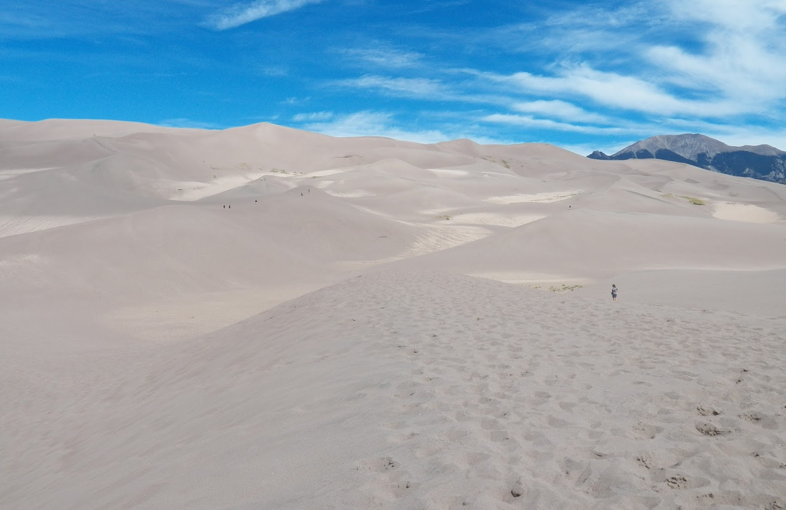
woke up to a stunning morning view of the Great Sand Dunes and the Sangre de Cristo
Mountains behind them. We first stopped at the Visitor’s Center to watch an
informative film on the sand dunes, which Joe had been puzzling over all night.
He said he just “could not understand what they were DOING there!”
 |
| View from our Campsite |
The thing is, the dunes are so impressive that it’s hard to
understand how they COULD come to be there, so far from any other sand. We left
the Visitors Center and went to the parking lot which is the access point for
the dunes. There we walked through the Medano Creek, which is a wide torrent in
the spring, but today was a wide collection of rivulets, some of them surprisingly
fast moving. I tried to avoid getting my sneakers wet by jumping over one of
them, and fell down into the wet sand. Luckily, I wasn’t hurt.
 |
| Joe in Medano Creek |
We walked out onto the sand “plain” which stretches at the
feet of the dunes themselves, and about 100 yards in, Joe announced, “See those
people up there on the dunes? They are CRAZY!” I asked him why, and he said, “This is really hard to walk in, and I
am NOT HAVING FUN.” So I left him on the plain, and I went on alone, determined
to climb at least one of the lower dunes.
The sand was not too easy to walk on, but it was a little
bit easier than the last time I tried walking on the sand at Sandy Hook in NJ.
Also, I was thankful that it was not terribly hot today, and there was a nice
breeze blowing. So I wasn’t miserable from the heat, I just had to push ahead
until I found myself on top of the first dune. It was not terribly high—maybe 30
feet? I have no idea! But it gave me an
elevated view, and I could see that to go any higher, I would have to first
descend my dune and climb up the next larger one.
 |
| On top of a dune |
I wasn’t really interested in going further—I’m sure
experienced hikers get a sense of accomplishment getting up there, but really,
climbing on sand is HARD! So I asked someone who was also content to stop at
that point if she would take my photo to prove I made it up there. And then I
trudged back to Joe. I had noticed he was actually lying down waiting for me,
and I was a little bit concerned. But he said it was just more comfortable that
way, pointing out that people lie on the beach all the time.
As we returned to the car, I took my shoes off to cross
Medano Creek this time. It was lovely—cool but not cold, and a lot easier than
worrying about my sneakers getting wet. On the way, Joe told me he’d figured
out why the dunes were there: he said it was God’s storage spot for beach sand.
He just hadn’t used it all up when He made all the beaches, this was the
leftover sand. It made as much sense as the story they told us in the visitors
center video!


After that, our day was all about driving. Until I really
looked at the map, I didn’t realize that the Sand Dunes are actually almost
exactly in the center of southern Colorado—not toward the east as I’d been
thinking. We drove a LONG way today, through about half of Colorado and on into
Kansas.

 |
| The road less traveled |
I did make one stop, feeling kind of silly about it, but I
couldn’t resist. We passed two places in Fort Garland, CO, which were legally selling
marijuana. One said on its sign that it was only for medicinal use, but the
large purple building we passed, called Green World, announced very clearly
that it was for recreational use. As I walked around to take a photo of the
sign, a customer leaving the store greeted me. He looked about my age, long
gray hair…. an “aging hippie” like me and the rest of my friends. I didn’t go
inside—since I was crossing the border in a short time, it wouldn’t have been
legal to bring home a souvenir, and I didn’t want to get high and be unable to
help with the driving. But I must say, it is great to see this social change
happening—one state down, 49 to go!
 |
| Legal Weed |
We aimed for Dodge City, Kansas, which was (I thought) kind
of a long drive, but really there were very few options for places to stop
before now. Our route took us on CO 10 until we joined US 50… for most of the
time, the road was very sparsely traveled. Unfortunately, the RV park we wanted
to stay at closed at 8pm, and the lady told us we couldn’t come (I called at
about 8:07.) The only other park I could find in my books didn’t answer the
phone. So we are staying at Chez Walmart. I can’t really complain, however—the price
is right, and it comes with wifi.
Tomorrow, our plan is to visit Dodge City’s museum, built on
Boot Hill, and find out all about this formerly wild frontier town on the Santa
Fe Trail (which we’ve been following today, along the Arkansas River.) And then we will continue on east.


No comments:
Post a Comment