Saturday, August 28, 2010

Our Last Night of Vacation

Aug. 27 and 28, 2010

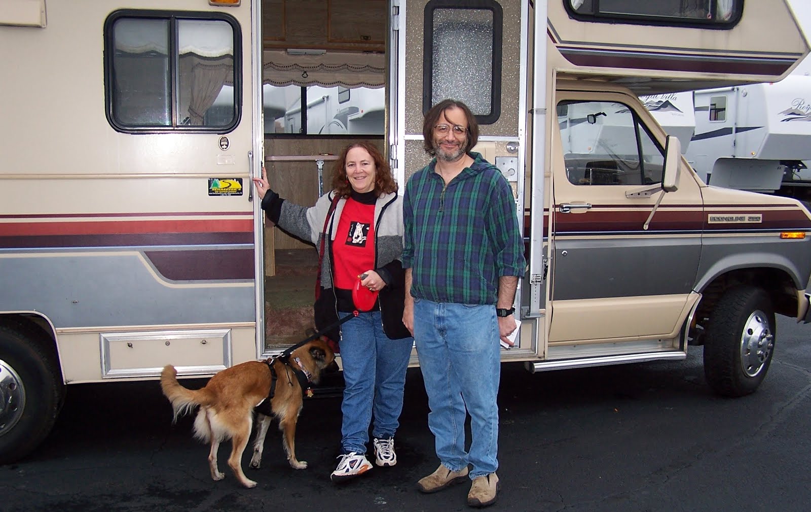
A double blog tonight--we spent last night sleeping at the Walmart Campground chain, which has no wifi. It's always fun staying at Walmart, however. First of all, the price is right. Second, once we pull our curtains, we have no idea where we are, and third, when we wake up in the morning, we never know who our neighbors will be. The photos below are both from this trip; the first was from a few days ago at the Walmart in Kearney, NE, and the second was this morning.
Of course, the Amish family at the K-Mart just arrived in the morning to shop; they didn't spend the night :)

For those who wonder, Walmart is only one of the standby places for people who need to sleep and don't care too much about the amenities. Cracker Barrel and Cabela's are among the chains which invite RVers to stop overnight. Interstate rest areas are of course always available; even when they say "no overnight stopping" or other such warnings, no one is going to bother you if you are there. Since we have everything we need--water, heat, electricity, etc--and sometimes all we want is to just stop driving and SLEEP, it seems crazy to spend $30-40 just to pull in, go to sleep, and leave in the morning. The advantages of campgrounds include showers and wifi; but not all campgrounds have those either (state parks may not have much in the way of showers, and of course not even all private campgrounds have wifi; none of the state or national parks do.) So we use all the available options and are quite happy pretty much anyplace.

Anyway, back to yesterday morning: we spent the morning and early afternoon in Amana, Iowa. The Amana Colonies were settled by a group of German immigrants who were known as the Communityof True Inspiration. They lived and worked communally, and built 7 villages in Iowa just west of Iowa City. They are known for the excellence of their handiwork--they began with all the rural skills of weaving, woodworking, etc. In 1932 they gave up their communal lifestyle and formed the Amana Society, a profit-sharing corporation, to manage the farms and other businesses which were formerly owned by the entire group.

It turned out that many of the Amana Heritage Sites were closed on Friday, but all the little shops in Amana were open, as was the Amana Museum. So we walked around the village, which was very quiet and peaceful. We went to the Museum, but spent more time in the shops. We especially liked the Amana Furniture and Clock Shop. They had exquisite furniture and wonderful clocks (although the clocks were mostly not made at this shop.) There was also a visitors gallery so we could see the actual workshop and watch the men working. Another place we stopped was a small place with a large, wonderful garden filled not just with flowers but with wire trellises and other garden decorations.

At about 2pm we quickly ate some lunch, realizing it was getting late and we had to move along. There was a lot more there to see; as usual, we will have to come back! Anyway, at that point we started driving and made it through the rest of Iowa, crossed the Mississippi into Illinois, and went halfway through Indiana before we finally had to stop.

Mississippi River

As I said, we got off the Indiana Toll Road (as I-90/I-80 are known there) and went to the town of Sturgis, as indicated by our Next Exit book, to find the Walmart. It was not until this morning, when we got back on the Interstate, that we discovered that Sturgis was actually in Michigan! I-80/90 runs right at the state line and although we only drove about a mile or so from our exit, it was enough to take us over the line. So it seems we inadvertently added a 12th state to this year's adventure.

We had no plans for today--our intention was to drive all day and arrive in Bellefonte, PA in the evening, and take our nephew Ben, who is at Penn State, out to dinner. We did have a brief stop on the way, however, to pick up a couple of replacement headlights. One of ours had been flickering last night, and this morning seemed dead. Joe checked it out today and bought replacements, but it seems it was the connector and not the headlight. It is all fixed again; he did the job in 30 minutes while I browsed in the Goodwill Store next door to the Advance Auto Parts. Then we returned to the highway.

We arrived at the Fort Bellefonte Campground tonight just at 7 pm. It is lovely, with gardens galore, animals (chickens, rabbits and goats), and wonderful grass. Roxy was ecstatic to run in the grass--I think she is heartily sick of this RV! Ben came up and met us (we are only about 15 minutes from State College), and we went out to a lovely dinner. And now it is about 11 pm and time for bed again. Tomorrow is our 39th anniversary, and we have to go home. But next year, for our 40th, I am hoping that we will be taking a one-month-long trip to celebrate. Meanwhile, I am planning to spend a few more weekends this month RV-ing. It is just too much enjoyment not to do it more often!

Thursday, August 26, 2010

On the Great Road


Aug. 26, 2010

We started out today in Kearney, NE, at the Great Platte River Road Archway Monument. This museum, which is literally built as an archway over I-80, is absolutely fantastic! It immediately reminded me of a ride at Epcot Center, except we walked through rather than riding on a moving seat. We were given a self-guiding audio tour via headphones, and the use of technology was really excellent. Each area had dioramas, video, and large panels with photos and historical information. At the same time, the audio portion came through the headphones, consisting of excerpts from diaries, radio broadcasts, and all kinds of other audio information.

The first floor of the museum consisted of the pioneer experience—be it on the Oregon Trail, the Mormon Trail, or the California Trail of the gold rush prospectors. The Trails started in different cities, but they all converged in the area of Kearney for a hundred miles or so, along the river near the site of the museum. We made our way through the rooms, starting with the hopeful emigrants searching for a better future, dealing with difficult weather, disease, and death; passing abandoned household goods and gravesites. All the while we heard the descriptions through our headsets and read the wall panels. The experience of the Native Americans was also included, of course. Finally we came to the end, and read and heard the expressions of joy, exhaustion, and new hope from those who survived what must have been a trek incomprehensibly difficult for us to imagine.

The second part of the museum dealt with the continuation of the travel westward, beginning with information—the pony express, and the telegraph—and then with the stage coaches, which offered a much faster way to traverse the country. Then came the railroad. Almost overnight, with the completion of the railroad, the uncomfortable and uncertain stage coach travel ceased.

But what moved us most was the development of the first transcontinental roadway, the Lincoln Highway. First of all, we grew up on the Lincoln Highway—even today, in Edison, there are signs on Route 27 which say “Lincoln Highway.” The highway ran from New York to San Francisco. The descriptions of travelers who could use their own cars to hit the open road without being “at the mercy of the train schedules” certainly hit home with us—I loved the tableau of the family with the tent set up, the table adjacent to their auto; and the small tourist cabins in the background. The quotes and memories coming through our headphones simply added to the wonderful experience as we vicarious lived both in the past and in our own present.

I took a photo of one of my favorite quotes: On The Road: "Informality is the password, snobbery is taboo, every man is your neighbor, and all are bound together by an almost unbelievably powerful tie--the dust of the open road."--Frank E. Brimmer, writer.

The last room on this floor showed us a large map of the US, which lit up all of these consecutive cross-country trails, tracks, and roadways following such similar pathways through central Nebraska along the Platte River. And finally, there was a window which looked down on the latest incarnation of the Great Platte River Road: Interstate 80 below the archway, with counters keeping track of both the eastbound and westbound traffic. Both Joey and I had a profound sense of being part of history—joining the thousands and millions who throughout the past 150 years have travelled this very route across our huge and beautiful country.
We left the museum and returned to our modern day covered wagon, and joined the great migration across America, this time heading east again. And that was what we did all day—travel through the eastern half of Nebraska, and across the Missouri River into the remarkably beautiful rolling farmland of Iowa. (We had hoped to time it right for a steak dinner in Omaha, as suggested by Rabbi Fellman which I wrote to him this morning, but we passed by the city at 3:30; we’ll have to come back someday for that—maybe when we follow the Lincoln Highway from home, all across the country!) Our favorite sight of the day was when we passed Adair, Iowa, which is home to a major wind-power installation. We saw at least 100 wind turbines twirling, spaced throughout the thousands of acres of cornfields. They were a stunning and beautiful sight, and we couldn’t help but wonder why more of these generators aren’t already in use all over the prairie states. We passed several trucks carrying the blades for the “windmills”, and they are simply huge, probably 100 feet long. They are very impressive.

We arriving just at dark at the Amana Colonies, and are expecting to explore a little bit here tomorrow before returning to the interstate. As I keep saying, each day just shows us yet more new roads that we long to travel. But for now, our road is leading us back home.
[Note: I had a lot more photos to upload, but this connection is taking forever; so I will try to upload them tomorrow. Iowa has WIFI at most of the rest stops, and it worked very fast this afternoon.]

Western Nebraska

Aug. 25, 2010

Western Nebraska—who knew? We have had a beautiful drive today, and added Nebraska (a quite large state, btw) to our states sticker map. We left Hot Springs around 9 a.m. and headed south, crossing into Nebraska at about 10 am or thereabouts. A roadside marker informed us that this portion of our trip was following the Fort Pierre-Fort Laramie Trail, originally used for fur trading. Our first stop was an hour later, in Alliance, to see “Carhenge”. Carhenge is a roadside sculpture, basically a combination of Cadillac Ranch and Foamhenge, two of our previous roadside sculptural stops (you can get the impression from this blog that we like this kind of funky, idiosyncratic roadside creation!) I think Carhenge might be a little bit smaller in diameter than the original Stonehenge which it was made to resemble, but it is definitely cute.
The field in which Carhenge stands is marked with a sign as an “Car Sculpture Preserve”, and there are a number of other automobiles in various stages of rearrangement. There is “The Fourd Seasons”, cars painted green, tan, white and pink (why did they start with summer, I wonder?) and there are several cars buried up to their noses with markers indicating that they are time capsules from various classes of Alliance High School (Alliance has about 9,000 people and there sure isn’t much around there other than fields, so I suppose the high school kids get creative in self defense!) There were also a few other oddball sculptures—a salmon and a dinosaur. Equally fun for us was the fact that the field was filled with thousands of grasshoppers, and with each step, they would fly up ahead of us. They had different colors and sizes and were pretty amazing. I didn’t appreciate it when they flew into my head, however—they don’t have great aim.
After Carhenge, we had a quick lunch and then hit the road in earnest. We headed south-east on US 26, which was marked on the map as a scenic route, and we were definitely surprised. We passed rock escarpments which were obviously carved out by a river, which looked much more like “out west” than the Midwest. I looked at the map, though, and realized we really were not that far from the state line between Nebraska and Wyoming; and later on, the line between Nebraska and Colorado. I think some of the remarkable rock formations of those states came over into western Nebraska.


Then we came to a detour which turned out to be to our advantage—instead of following US 26, we were directed onto NE 92, which ran just along the northern shoreline of Lake McConaughy, a very large lake which was a beautiful blue color and which was obviously a destination for recreation in south-central Nebraska. I forgot to mention, but pretty much all day we’d been on roads with very little traffic, and that sure is nice. Once we rounded the eastern end of the lake, however, we were only a few miles away from I-80, and we had to give up our week of empty roadways.

On I-80, I stopped at the first rest stop I came to, hoping for some tourist brochures. There was nothing like that, but it was a worthwhile stop anyway—the info on the walls told us that we were following (in reverse, of course) the same route which the pioneers travelled—the Oregon Trail, the Great Platte River Road, the Mormon Trail, the pony express, and the first interstate railroad line. All of these followed the Platte River, as does I-80. At the rest stop, they had set up wagon wheels to indicate ruts in the grass across the back of the rest area, which was the path taken by wagon trains which were coming around the bluff we were on. It was very cool and of course made me wish I could travel slowly on US-30, the Lincoln Highway, which also follows this route and has lots of interesting sites to see along the way.

At that point, though, we hit the gas, and travelled at about 70mph (the speed limit is 75) until we stopped for gas at the town of Gothenburg. Right at the gas station was a small museum with a recreation of a sod house. Unfortunately the museum was closed, but we were able to look in the sod house, which was interesting. Also in Gothenburg is an original pony express station building, and so we drove a few blocks into town to see it. That was still open (it was 6:45pm) and the lady inside gave us a little shpiel about it. It was really very interesting, and we enjoyed our stop.

One more hour on the interstate, and we are now in Kearney, NE for the night. In looking at the map of the US, it seems to me that Kearney may just be exactly in the center--east-west AND north-south! As the pioneers did at Fort Kearney, we too are stocking up on provisions for our journey—but our general store is a Walmart. Tomorrow morning we will be going to the Great Platte River Road Archway Monument, a museum dedicated to the westward migrations and to the subsequent freedom of travel across America. The monument itself is built right across I-80. I have wanted to visit this for a long time and we will spend some time there tomorrow before heading east again. As with so many other places I’ve visited, my quick trip through Nebraska just make me want to come back again at a slow, leisurely pace and stop at all the museums, historical markers, and other points of interest along the Lincoln Highway without having to always pick and choose between them.

Tuesday, August 24, 2010

Visionaries


Aug. 24, 2010

Today we spent another day in the Black Hills. We woke up to an absolutely scrumptious day—not a cloud in the sky, and crisp cool weather. I think the latter was helped by the fact that we were up on the side of a mountain, not down in the valley of Deadwood. I decided that after all, I really did want to see Mount Moriah Cemetery, even though I likely wouldn’t get to see the Jewish graves unless we walked up to the top of the hill (and bear in mind, this is not a “hill”, it is a MOUNTAIN.) So anyway we subjected ourselves to one of the 1-hour guided tours which tend to overemphasize the Wild Bill Hickock stories and are less heavy on the history. At least, our tour was like that. The lady at the tourist office said to “pick whichever tour fits your schedule better, they are all excellent”, but our tour guide seemed to specialize in horrendously corny and stupid jokes.

However, we did get the ride up into the cemetery, and it was abundantly clear that Joe and I could *never* have walked up it yesterday, and probably not ANY day. The road up was longer than we’d realized before we even reached the cemetery gates, and then we continued up even further inside. The bus stopped at the gravesites of Wild Bill and Calamity Jane (who is buried right next to him, allegedly as per her request), and Potato Johnny, another colorful Deadwood character. We also stopped for a view of Deadwood—the dead have the best view of the town. I was unexpectedly happy to discover the historical marker about the Jewish gravesites right at our stop, at the corner of David St. and Jerusalem St.—apparently not everyone wants to have to climb up to the VERY top of the hill to read a historical marker. The Jews are buried at the highest part of the cemetery, and if we’d left the tour at that point to go see their graves, we’d be climbing yet another very steep section of walkways. Also it was interesting—on the way out, I noticed that the designs in the iron gates included a Jewish star. Unfortunately the bus was at a bad angle for me and I couldn’t snap a photo in time.
After our bus tour, we did a little bit of shopping. Then we went back to Mo for some lunch, before heading south out of town. We followed Route 384 through beautiful Black Hills scenery, until we reached Crazy Horse, our destination. The sculpture of Crazy Horse seated on his horse, pointing out over the landscape, is going to be the biggest sculpture in the world, by far. So far the only part which is completed is Crazy Horse’s head. It is so monumental that the faces on Mount Rushmore, only 17 miles away, would fit into Crazy Horse’s head. Work on the sculpture has been in progress for 60 years so far.
The project is supported solely by private donations and by the proceeds from visitor fees and purchases at the Crazy Horse Monument—no government money at all. To attract tourists, the site includes not just the view of the mountain carving, but an orientation film, galleries of photos about the project, an Indian Museum, the Native American Cultural and Heritage Center, the studio and home of Korczak Ziolkowski (the sculptor of the work), a restaurant, and a large gift shop. We spent about 3 hours there.

The most interesting parts to us were the historical items and photos dealing directly with the work of beginning and continuing work on such a gargantuan project. From the first letter written by Chief Henry Standing Bear to Korczak asking him to participate in creating a heroic memorial on behalf of the Native American peoples, to the photos of the first blasts of dynamite and the careful photo record of the sculpture’s advance since then, it was fascinating to see how this dream became reality.


What is truly amazing is that none of the people who began the project could ever expect to see it completed; since Korczak’s death, his wife Ruth (now 84) has directed the work, with the help of 7 of her 10 children. At the time when the actual work was begun, the first blasts were attended by the last 5 living tribal elders who had been at the Battle of Little Big Horn! Tonight Joey and I were estimating that we would not be alive when the horse’s head was completed; and thinking about the rest of the sculpture, it will probably take another couple of hundred years. The scope of the project is just mind-boggling.

We finally left Crazy Horse and continued south to Hot Springs. The drive was beautiful; it was after 6, and that is when the wildlife is supposed to be more active. We drove through Wind Cave National Park (which we saw in 2007) and in addition to seeing deer, prairie dogs, and wild turkeys, we also encountered bison at a roadside overlook, and standing in the road nearby.

As for Hot Springs, we stayed in this town 3 years ago to visit the Mammoth Site and head north to Deadwood; today we reversed the trip. We are now in the same KOA we stayed in 3 years ago—it is shaded and nice, and the wifi seems good. Tomorrow we will head further southeast into Nebraska, and get our last new state sticker for this vacation.

Monday, August 23, 2010

Jews in Deadwood


Aug. 23, 2010

After we completed the Enchanted Highway portion of our drive, and the beautiful agricultural landscapes of North Dakota, we crossed the state line and soon discovered that the land in this northwestern corner of South Dakota quickly became endless ranchland rather than unending farms. We passed a lot of cattle, plus quite a few sheep. The land began to change and soon there were outcroppings of rock and large stands of dark green trees. We could see the Black Hills in the distance and suddenly we were there.
We entered the Black Hills area via Sturgis, and quickly found our way to Deadwood. We had spent a day in the Black Hills, including dinner in Deadwood, on our 2007 trip, and really enjoyed it. The entire city of Deadwood is a National Historic Landmark, and there is a lot of tie-in between the current businesses and the historic sites. New buildings have to match the old ones they replace, and casinos (there is legal gambling in Deadwood) are encouraged to maximize the old west theme. There are markers and explanatory information in many places.
This time I was determined to do something I couldn’t find time for in 2007, and that was to trace some of the Jewish presence in Deadwood. Thanks to an article in the Jewish Forward newspaper, I had some information to start with. So after parking Mo and picking up some tourist info and maps, Joe and I walked a few blocks from the parking lot and found ourselves on the historic Main Street of Deadwood. We were heading for the Adams Museum, which among a lot of other fascinating displays about the history of the Black Hills area in general and Deadwood in particular, has a display dealing with the Jewish merchants who were among the founders of the town. At the museum, we read about Harris Franklin, Jacob Goldberg, and Sol Star, Deadwood’s mayor for 14 years. There were photographs and other archival materials which gave texture to the Jewish contributions in helping Deadwood to overcome its wild-west reputation and turning it into a respectable town.
As we walked up and down Main Street we took photos of stores which had been owned by these men, helped by a marker on one corner which detailed some of the information and identified buildings which had been built by Jews or were sites of Jewish-owned businesses.


It was a lot of fun, and nice to have a focus besides gambling (not our interest) and shopping (the Black Hills Gold which is to be found everywhere is one of my favorites, but I have so much of it already!) I am disappointed that we did not have time or energy to go up into Mount Moriah Cemetery, better known perhaps as “Boot Hill”. This is the cemetery where Wild Bill Hickock and Calamity Jane are buried—but I had wanted to visit “Hebrew Hill”, the site of the graves of the Jewish founders of Deadwood. The path is extremely steep and we never even made it to the cemetery gates before realizing that at 5 pm after such a long day’s drive, it was just beyond our strength today.

We walked around town for about 3 hours, before heading back to Mo to find a campground for the night. We had absolutely no “bars” on our cell phone, so we couldn’t call anyplace; as a result, we decided to head for the same KOA campground where we stayed 3 years ago. And here we are, two sites away from our previous one, both exhausted (in fact Joe is already asleep). But it was really a wonderful day.

Enchanted Highways


Aug. 23, 2010

Another wonderful day! This morning, we woke up at 7 am to find that the 90+ degree weather from yesterday had become downright cool! In fact I dressed in long pants and Joe wore a sweatshirt, and my feet were cold in sandals. We left our campground a little before 9 am for our drive to South Dakota. If we had gone the fastest possible way, it would be about a 4 hour drive, but we took a longer way in order to drive on the “Enchanted Highway”.
The Enchanted Highway begins with the Flying Geese sculpture we saw a few days ago on our way to Medora . The highway goes due south from there, with seven or eight other huge metal sculptures by the same artist along the way. So that’s the direction we took. We were charmed by the folk-art quality of the sculpture, which were not just huge but whimsical and with small special touches (fx, the Grasshopper was surrounded by smaller grasshoppers and large waving stalks ofwheat, and the parking lot border matched the wheat; the Fisherman’s Dream was surrounded by a border of waves, etc.) We stopped at each one to take photos, and at a few of them, we let Roxy out to run around at the same time.


The Highway was Enchanted in another way, too—we were the only ones on it! Well, not entirely; but I don’t suppose that we saw more than a few dozen cars on the entire length of highway. At one stop, I stood in the middle of the road and took photos in both directions, crossing back and forth repeatedly. Joe used the chance to clean off Mo’s windshield. During the entire time, not a single car or truck passed in either direction—it was at least a 10 minute stop. It would have been simple to see anyone coming—the road was as straight as an arrow, with only a gentle up-and-down over the hills. When we DID see a vehicle, it was always a pickup truck or a larger transport truck—we didn’t see any “regular” cars and not another RV or anyone else who appeared “touristy”. Once, Joe missed the driveway for the turnout at the sculpture; he simply stopped Mo and backed up on the roadway. There was no one coming in either direction.
We reached the end of the highway in Regent, ND, a small town with one street. There was a gift shop, a co-op grocery, a post office, a gas station, an American Legion hall, a small billboard announcing that Regent was the hometown of one of ND’s US Senators, and that was pretty much it. We drove right through but a half-mile later I said to Joe, “I think it was a mistake not to get gas there; I don’t know when we’ll see another gas station.” So we went back and got gas. We also went into the gift store, took photos of the last metal sculpture (which, unlike the others, was not quite so monumental and we’d missed it somehow), and mailed a postcard in the little post office. The cutest thing we saw was a metal evergreen tree (another sculpture, of course)--there were *real* birds nesting in it!

It turned out to be a very good thing we’d gotten gas, because it was many many miles later before we passed another town of any size. Some places which are on the map literally don’t exist, or all they have is one building (seriously; we ate lunch in Reva, South Dakota—there was one building called “The Store”, which had a post office drop, a small convenience store selection of groceries, and a couple of booths to sit and eat your purchased sandwich at. And that was it for the entire town.) That corner of the world—southwest ND and northwest SD—is very very sparsely populated, and again, we just didn’t see many cars for hours.
What we DID see was absolutely beautiful farmland in North Dakota—thousands of acres of wheat fields, interspersed with sunflower fields. The gently rolling countryside stretched literally to the horizon, and was gorgeous. The day was beautiful—sunny, with fluffy clouds—and our eyes just drank it all in for hours. This is why we love travelling this way; there is simply no way to comprehend how huge and how beautiful our country is without driving through these miles of “nothing”. It is really something.

Sunday, August 22, 2010

Teddy Roosevelt's Park


Aug 22, 2010

Today was our Medora Day. Medora is a little town which is the entryway to the South Unit of Theodore Roosevelt National Park. Medora was founded by the Marquis de Mores, a VERY handsome man (we saw his photo, and he looked like a movie star!) who came here from France. He built a meat-packing plant and convinced the railroad to open a depot in Medora (which he named for his wife, who was from New York.) His father-in-law bankrolled his many ventures here but ultimately they failed. The town, however, stayed, partly due to the interest taken in it by Theodore Roosevelt (who arrived here 2 years after the Marquis and was friendly with him.) The town trades very heavily in its connection to Teddy R, and it currently bills itself as “historic Medora”, with all the little touristy buildings (souvenirs, fudge, snack bars, etc) made to look 100 years old.

We spent all morning in the national park, skipping the visitor center at first in favor of the Scenic Loop Drive. The first stops included a prairie dog village and a wonderful scenic overlook. I can never understand why I think prairie dogs are so cute—I wonder if people from places without squirrels think our squirrels are cute!

But the big stars (and I mean BIG) of the morning were the bison! I first saw them down in the valley near the river (the Little Missouri River runs through the park, the town, and next to the Medora Campground where we stayed last night.) A whole herd of them, which seemed to be moving directly toward the Cottonwood Campground (which is the park’s campground).

As I zoomed in to take their photos, Joey said, “Look ahead!” and there was another herd parked right next to the road just ahead of us. So we stopped and gawked and took photos with all the other tourists.

I should add here, “all the other tourists” may give the impression that the park was crowded. Nothing could be farther from the truth. Almost every stop we made, we were the only ones there, or perhaps there would be one other family. A crowded stop had 3 cars at it, and for most of the scenic loop, we were the only car we saw. It was really nice not to have a lot of people around; when we turned off Mo’s engine, there was not a sound other than the wind and the crickets as we looked out over this unworldly vista below us.
One stop was a 360-degree view of the countryside around us. We could see oil wells on the horizon (past the boundaries of the park), I-94 below us (the interstate runs runs right along the border of the park, and at one point, there is a park bridge over the highway), and nothing else but badlands. The three of us (Roxy went on these little jaunts) loved it, and the hot sun was greatly mitigated by the breeze.
We spent several hours on the loop (we also saw some beautiful wild horses near the road as we drove) and were headed back to the Visitor Center area for some lunch when we passed the Cottonwood Campground area again. The herd of bison which had been down in the valley earlier had made their way through the campground and onto the meadows next to the highway. Several bison remained on the road to the picnic area/campground, and of course about 6 or 8 cars and campers were stopped with all of us taking photos. Roxy, who had been uninterested during our earlier bison encounter, suddenly looked out the window, saw these huge creatures only a few feet away, and went nuts barking at them. Apparently she was telling them to get off the road, because they did, and we headed down to look at the picnic area and check out the campground.
We had not stayed at this campground last night, because it has no electricity or showers, and we were coming off a two-day drive and expecting a hot night. The campsites were really pretty, however, much larger than the parking-lot style we’d had last night, and we were considering staying there tonight. Our interest was increased by encountering a few stragglers from the bison herd, who were trotting through the actual campsites to catch up with their friends. When we went around into the picnic area, we met them again, having their own picnic. Roxy was outraged and let them know it, but we went back out (having to make our way around yet more bison in the road) and had lunch in the parking lot next to the visitor’s center instead.

After lunch we went into the center. It has a small but very interesting and well done museum about the park and about Teddy R’s interest and connection to the area (he owned an interest in two ranches here.) We saw not only his own stuff--rifles, clothing, models of his ranch house,etc—-but the skeleton of a crocodile-like dinosaur which was found in the South Unit, and information about the bison herds. We spent about 30-45 minutes enjoying the exhibits and the air conditioning. (Luckily the breeze was blowing right through the camper so Roxy was okay, too.)

We then decided not to go up to the North Unit of the park. Although it supposedly is prettier, we felt happy with the beauty we’d seen, and the North Unit is an hour drive each way. I was feeling lazy, and wanted to have a little quality time in Medora, if such a thing were possible. So we went into town (literally two blocks from the national park visitor center) and stopped to ask a few questions. It turned out that one of the stores offered free wifi (and even computers) so we parked by it and found a connection, and I posted the blog I wrote last night (the campground wifi had gone down and I couldn’t get anything from it, which was why i hadn't posted it earlier.) Then we walked on the street and had some ice cream, and discussed our next move.

We voted to come back to the Medora Campground (with the heat at 94-degrees, we decided electricity was a good thing!) and to wake up early tomorrow to drive to South Dakota. We also decided to do something VERY touristy tonight—we are going to the Pitchfork Steak Fondue Dinner. This was apparently seen on “Best of” on the Food Network—a big selling point, LOL! The steaks (you get a choice of 12 oz rib steak or 9 oz NY Strip) are speared onto pitchforks and fondued “western style” in boiling oil (!) This is served with a “fixins bar” of baked potato, beans, veggies, etc. We will also be “serenaded with western melodies performed live by the cast of the Medora Musical.” It should definitely be an experience, LOL!

So now we’re at the Medora Campground with the AC on while I write this, and Joe finishes his book. Despite the AC it is way too hot, and I have a fan going as well. I washed up a little bit when we got here, and wow, our hot water is HOT—all from solar heat during the day (I’m not sure where the tank actually is but it was hotter than my shower this morning.) The good news is, the weather is supposed to break tonight and tomorrow is supposed to be 20 degrees cooler.

After dinner addendum: well, THAT *was* an “experience”, LOL! What a bizarre scene! There must have been about 250 people there (including 3 tour buses). We were very glad that the lady who greeted us as we came in suggested sotto voce, “get in line QUICK!” We did indeed, which meant that 30 minutes after the dinner gong rang, when there was STILL a long line of people waiting, we were finishing up our meal. It came as no surprise that a steak which has been “fondued” is NOT the best steak you ever ate—too well done by far. We were handed a color-coded plate and we made our way down the line of veggies, potato, cole slaw, garlic bread, baked beans, etc. And then we walked up to the cowboys with the steaks in front of them, and they speared us a steak to go with our meal. The steaks themselves were cooked in big vats of oil and I took photos of the pitchforks full of meat and the cooking process.

We ate at long LONG tables with everyone else, and watched the other people and watched the sun going down on the badlands landscape around us. That was the nicest part of it all—the restaurant/theater was on top of a high butte and between the parking lot and where we ate, as we walked, we had a 360 degree view of the landscape. A very beautiful “restaurant” with a bizarre “concept” and (unsurprisingly) mediocre food. I did it so you don’t have to-—no need to thank me!