 |
| Standing in the Middle of the Grand Coulee Dam |
We left our casino “campground” this morning, noticing that there were about 15 campers there, but all the concert-goers had cleared out. The weather seemed pretty nice, although a little cloudy, but soon after we got onto the road, it started raining, and rained lightly on and off all day.
We arrived at our destination, the town of Grand Coulee, around noon, after pulling out a couple of times for those cute road sights that make road trips so much fun. We went through the town of Wilbur, Washington, not expecting much—but encountering Wilbur himself, complete with a spider-web announcement of his presence. I love a town with a good sense of humor!
 |
| Outside the Wilbur, WA Visitor Center |
After the film, we looked at the many displays on all the facets involved in building a dam. Ironically, I realized that the parts that interested me most—the human interest aspects—were far from unfamiliar. The section on the displacement of the 7 or so towns which were flooded by the new Lake Roosevelt reminded me strongly of the towns I saw in China in 2001, during the building of the 3 Gorges Dam. (The process of building was familiar, too, when I heard on the film—before I fell asleep—that they built a “coffer dam,” I remembered I’d seen the 3 Gorges coffer dam and even gone with our tour to look at it more closely.) I vividly remember how full of life the villages were, and the realization at the time that their days were numbered, the inhabitants would be moved, and the site of that town drowned as the river backed up from the new dam.
 |
| The Grand Coulee Dam |

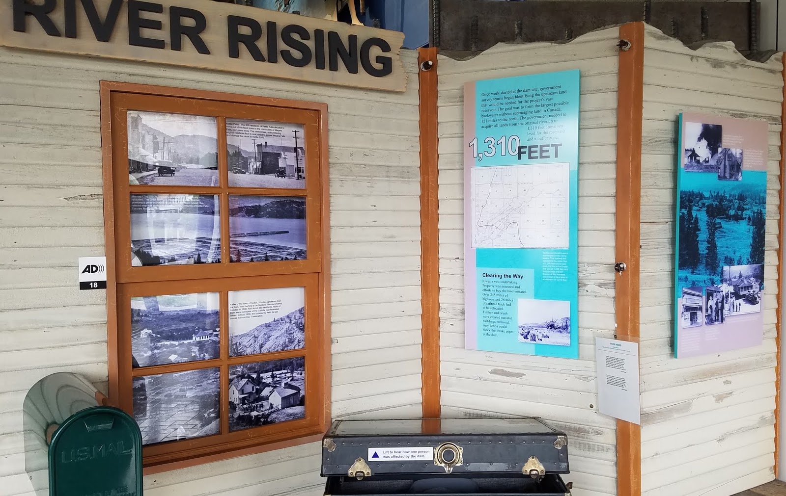 |
| Museum Exhibit on moving towns out of the way of the dam |
 |
| Inside Pump House #1–Giant Pumps |
I loved the view from the middle of the bridge. There is a full two-lane road up there, and sidewalks, all of which were open to the public until 9-11. After that, the access was curtailed, and now it is only accessible via a guided tour like the one we were on. But I did take what I think is a great selfi of Joe and me up there.The guide said that the mass of the dam is greater than any other structure in the world except one.... the 3 Gorges Dam!
After our tour was over, we left the visitor center and drove back up the hill to a road I’d noticed on our way down—it had a Campground sign and a brown shield, which indicated a US Recreation Area or National FOrest— I wasn’t sure exactly what it was, but I’d pegged it as a good place to spend the night. It turned out to be the Lake Roosevelt National Recreation Area, which was established all along the lake which was formed by the dam, following up the line of the Columbia River. This is the southernmost point, and we can see the dam from our campsite.
 |
| View of Lake Roosevelt from campsite |
The campsite itself is lovely—a beautiful view of the lake, hills around it, and the dam and town in the near distance. There’s also a path down to the lakeside, if we wanted to launch a boat. We just love the view!
Just after we parked and set up, though, it started to rain. We were concerned for our evening plans, but the payoff came when the rain stopped. There was a stupendous rainbow right outside our window! When I ran out to look at it, I saw the other end of the bow was also visible, and wow, it was just GLOWING. I was unable to really catch the effect on my phone camera, but it did come out quite bright in the photos. We were just outside loving it, and finally had to go back to eat dinner. The rainbow lasted at least 30 minutes. It was just gorgeous!
After we finished eating, it was time to drive back to the visitor’s center at the dam. Every night, they have a laser show using the dam as the backdrop! Because it’s so late in the season, there were very few people there, and we parked our car right up against the wall so we could see the show from inside. I did sit outside on the stone “bleachers” for a bit, but finally got a little too cold. It seemed most folks felt the same. The show was cute— a story of the different people who came to the area, and the effect building the dam had on the Indians who lost their salmon fishing access. It was a nice show. After that, we came back, and I tried to write my blog, but I was actually too tired (maybe from the change in time zone?) so I just went to bed. Here it is, going up in the morning, with all the last photos at the VERY end.


No comments:
Post a Comment